Randonnée Marche מועצה אזורית גליל תחתון - Jesus Trail - Golani Junction-Capharnaüm - Itinéraire officiel - Photo

Jesus Trail - Golani Junction-Capharnaüm - Itinéraire officiel

 waesberghe
waesberghe

Utilisateur

© OpenStreetMap contributors
Longueur
Longueur
39 km
Altitude max
Altitude max
315 m
Dénivelé positif
Dénivelé positif
697 m
Km-Effort
Km-Effort  
50 km
Altitude min
Altitude min
-213 m
Dénivelé négatif
Dénivelé négatif
1121 m
Boucle
Boucle
Non
Date de création :
2019-02-09 11:05:19.832
Dernière modification :
2019-02-09 15:08:05.584

(0 Avis)

Marche
Marche
24h26
Difficulté : Très difficile

Scannez ce code QR pour ouvrir la randonnée dans l'application SityTrail

Application GPS de randonnée GRATUITE

Logo SityTrail SityTrail

IGN / Instituts géographiques

Télécharger SityTrail sur l'App Store Télécharger SityTrail sur Google Play

Logo SityTrail SityTrail World

Le monde est à vous

Télécharger SityTrail sur l'App Store Télécharger SityTrail sur Google Play Télécharger SityTrail sur Huawei AppGallery

À propos

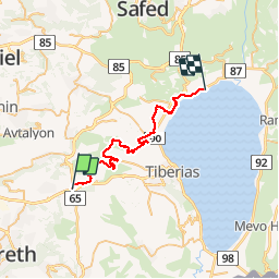
Randonnée Marche de 39 km à découvrir à District nord, Inconnu, מועצה אזורית גליל תחתון. Cette randonnée est proposée par waesberghe.

Profil altimétrique

Localisation

Pays :
Israël
Région :
District nord
Département/Province :
Inconnu
Commune :
מועצה אזורית גליל תחתון
Localité :
Unknown
Départ:(UTM)
725454 ; 3628903 (36S) N.

Randonnées à proximité

Randonnée Marche מועצה אזורית גליל תחתון - Jesus Trail - Golani Junction-Arbel - Itinéraire officiel - Photo
Marche
waesberghe

Marche

Très difficile
מועצה אזורית גליל תחתון, District nord, Inconnu, Israël
21 km | 26 km-effort
24h 26min
Non
Randonnée Marche מועצה אזורית גליל תחתון - Jesus Trail - Golani Junction-Arbel - Photo
Marche
waesberghe

Marche

Très difficile
מועצה אזורית גליל תחתון, District nord, Inconnu, Israël
17,3 km | 22 km-effort
4h 41min
Non


Fermer
Mes abonnements